Tag Archives: History

Tajikistan

23E5C4EB-51D9-41B7-A2BB-17B410780C3C

The Republic of Tajikistan is a mountainous, landlocked country in Central Asia with an estimated population of over 9.25 million.  It is bordered by Afghanistan to the south, Uzbekistan to the west, Kyrgyzstan to the north, and China to the east. The Tajik people are those who speak the traditional language Tajik, a dialect of Persian, though generally Russian is the language used today.

Branch of ripe cotton on the cotton field, Uzbekistan

Following the end of the American Civil War and the end to slavery there, the world’s chief source of cotton disappeared. The Russian Empire eyed Central Asia as a place where it could grow its own cotton.  By 1885, Russia had taken control of Tajikistan and replaced all of its grain production with cotton.  The Soviets expanded the cotton production and today, cotton remains the country’s main export.  Tajikistan is the poorest former USSR country.

The fall of the USSR and the independence of Tajikistan sent the country into a five-year civil war that left tens of thousands dead and one-fifth of the population displaced.  The end of the war saw Tajikistan nominally a democratic republic, but there is virtually one political party and strongman President Emomali Rohman, a former cotton farm boss installed in 1994, has remained in power ever since.  Each mention of Rahmon in the media is preceded by his official title: “founder of peace and national unity, leader of the nation.”  The government has been criticised by a number of non-governmental organizations for authoritarian leadership, lack of religious freedom, corruption and widespread violations of human rights.

Although the political system is secular, Sunni Islam is practiced by 98% of the population and was declared the official religion in 2009 although Rohnan reportedly despises the religion.  1.2% of the population are still Zorastrianism, an ancient religion formed in Iran.  I was curious, so…

Zoroastrianism

Zoroastrianism is one of the world’s oldest continuously practiced religions.  Major features of Zoroastrianism, such as messianism, judgment after death, heaven and hell, and free will may have influenced other religious and philosophical systems, including Second Temple Judaism, Gnosticism, Greek philosophy, Christianity, Islam, the Bahá’í Faith, and Buddhism.

AEC24CB8-7E88-4648-B562-C79F3E5E3C80

Zoroastrians pray in front of a fire, which represents purity and sustainability

In Zoroastrianism, the purpose in life is to bring happiness into the world and battle evil..  We could use a little happiness right now!  Zoroastrianism’s core teachings include:

  • Follow the Threefold Path of Asha: Humata, Huxta, Huvarshta (Good Thoughts, Good Words, Good Deeds);
  • Charity is a way of maintaining one’s soul aligned to Asha and to spread happiness;
  • The spiritual equality and duty of the genders; and,
  • Being good for the sake of goodness and without the hope of reward.

A good Easter message, don’t you think?

Tourism

0CB75CCB-98B7-4975-B18A-A22D106E9082

The spectacular scenery and opportunities for mountaineering and adventure travel are boundless and tourism was being promoted and growing until the COVID outbreak.    Many companies are offering tours of this land of the Silk Road for its stunning scenery and friendly people.

6E89D9AF-2B29-49F8-AB15-2E48026F82D8

Lonely Planet says:  “The term ‘predominantly mountainous’ doesn’t do justice to a country where over 90% of the land is upland. This fact of nature has given Tajikistan a precious advantage over its neighbours, namely some of the most inspiring, high-altitude landscape in the world. Within an hour of Dushanbe lie multi-hued lakes, peaks that beg to be climbed and high passes that thrill even reluctant travellers. In among this natural splendour are scattered villages and towns….  For visitors tolerant of a few travelling hardships (outdoor loos, cold water, potholed roads), the country more than compensates with a rare glimpse into life lived on ‘The Roof of the World’.”

Let’s go!

Khujand

229C5180-AF30-4B36-AB4F-F329AD368168

Khujand is one of the oldest cities of Central Asia, founded in the 7th-6th centuries BC. It was conquered by Alexander the Great, who rebuilt, fortified and re-named it to Alexandria Eskhata (Extreme). Located on the Great Silk Road, and connecting Samarkand with Fergana Valley, Khujand enjoyed a favorable geopolitical location and significant transport importance. Later, it was conquered by the Arabs (in the 8th century), and then it maintained resistance to the army of Genghis Khan, but eventually was destroyed (in the 13th century). However, very soon the city revived, becoming one of the largest commercial, cultural and scientific centers of the Central Asian region.

8FF407F5-4F13-42E3-B2BA-F662F007E0EE


A visit to Khujand Fortress, constructed 2,500 years ago, and the regional history museum are musts for visitors who want to know the history of the region.   

We won’t want to miss soaking up the culture at the Panjshanbe Bazaar!

Pamir Highway

Now it’s time to leave city life and be stunned by the gorgeous mountains, scenic valleys and alpine lakes that make this country such a wonderful destination. We’ll head out on the Pamir Highway which connects Tajikistan with neighbouring Afghanistan, Uzbekistan, and Kyrgyzstan.  This highway, the M41, is one of the highest in the world, with the peak point at Ak-Baital Pass, which is 4,655 meters above sea level.

Along the way, look out for flocks of yaks. If you are lucky, you may get a chance to spot the elusive but majestic Marco Polo sheep in the higher stretches of the surrounding mountains.

Iskanderkul Lake

8805148F-CEA8-47F7-94C0-818F100745F2
On our way to the Fann Mountains we will pass the beautiful Iskanderkul Lake, an excellent place for outdoor activities such as hiking, camping, and swimming. It is sandwiched between the beautiful Fann Mountains and is one of the largest glacial lakes in north-west Tajikistan.


The Haft Kul:  Seven Lakes in the Fann Mountains

In earliest times, an old man living among the Fann mountains went missing. After many days without his return, his seven daughters began crying until they each drowned in a flood of their own tears, creating these beautiful lakes.  Each lake represents one of the man’s daughters.

That is the legend, but the more likely cause was earthquakes.  The Haft Kul is comprised of seven stunningly beautiful lakes in a narrow rocky valley that range in colour from black to vibrant turquoise. The name Haft Kul literally translates to Seven Lakes in Tajik. You may also hear the area referred to as Seven Lakes, Marguzor Lakes, or the Seven Lakes of Marguzor. For those short on time and not feeling up for trekking, 6 of the 7 lakes are reachable by vehicle.

If you’re in Dushanbe, it must be Monday

The country’s capital city was always known as Dushanbe before the name was formalized.  Monday (“Dushanbe” in Tajik), was market day.  And that’s where we’ll start our tour of the city, at the Mehrgon Bazaar.

E7BD11A7-766C-4631-BA26-8F4CC05DA52E
In the afternoon we’ll feast on some delectable local, home-cooked cuisines at the food stalls in the afternoon, including Qurutob, the other Tajikstan national dish.


Here, you can try it at home!


This World

O my valuable, o my gloomy friend,
O my fellow whose cries have no end.

The gone is gone, the becoming you can’t explain
The past is past!  Obstinate, why do you complain?

Go cry to the ends of time, if you wish!
You can’t return to life, a lifeless fish!

You’re life will get harder and harder-
If you complain for every blunder!

A bain awaits your heart, if you look
At its every desire, at its every hook!

Defeat the army of gloom assailing your heart,
With the power of wine, you carry in your cart!

Greatness and wisdom only come to you-
With the perils and pain you stroll through.

– Rudaki (858-941) (translated by Maryam Dilmaghani)

Timeless, isn’t it?

FF394E7B-001B-43E5-8AA4-42246833C55D

A visit to the Memorial to Tajik writers (Wall of Great Tajik Writers) will acquaint you with the history of Tajik literature. It features the statues of famous novelists, poets, playwrights, and other writers of Tajikistan.  The “Wall” is the facade of the Writers’ Union building in Dushanbe, home to an association of novelists, poets, playwrights, and other writers. The large wall is carved with nine niches containing eleven life-size statues of famous Tajik writers, a tribute to Tajikistan’s Persian and Soviet history.  The 8th-century “Adam of Poets,” Rudaki, justifiably takes the centre stage. He is considered a father of classical Persian literature, though sadly only a small portion of his work has survived the test of time.

69B0459C-7189-4E36-B648-FF4BA54B8057


The tidy avenues of Dushanbe lined with beautiful pastel frontages belie the violent civil war that ruined the city streets in the 90s. Stroll down the side streets, and you’ll see how Dushanbe is transforming.

94AE1AEE-6D37-4BCA-A347-61EE385541EA


The Hissar Fortress – a palace of the ancient Bukhara Emirate – can be visited on the outskirts of Dushanbe. Enjoy the calm and peaceful atmosphere while exploring the fortress.


Kulai-Khum

E71C24AB-572A-44D2-89A0-97FA092DC768With a river raging through the centre, channelled between houses with terraces overhanging the impatient water, and with an attractive mosque and civic buildings, Kulai-Khum (Darvoz) is one of the Pamir’s most attractive towns. It is the first community of any significant size between Kulob and Khorog and as such one that most driver-guides attempt to reach as an overnight stop from Dushanbe, and we will join them.  Hopefully, we won’t end up like these guys!B3C58E6E-54FD-4F31-808E-0B5D97078C99

Khorog

This is the “highway” from Dushanbe to Khorog:

9B7A44E2-F932-4721-9A67-F063C89B66E3

Khorog is nestled at the foot of the Wakhan Valley, offering a dramatic mountainous landscape while also making the city feel like a cozy safe haven from harsh Pamir winds.DF4BE37A-2D2D-48D1-9901-2445101866B0

Home to a large population of Ismaili Muslims and the poorest city in Tajikistan, Khorog receives funding from Aga Khan, the 49th imam, which means the city has its own university, twelve schools, and hosts one of the three campuses of the University of Central Asia.  As a result, most people here speak English as well as the Russian most people use day-to-day.


Khorog boasts the second-highest botanical garden in the world, the Pamir Botanical Garden.

From Langar to Murghab

Khargush Pass is a high mountain pass at an elevation of 4.344m (14,251ft) above the sea level, located in the Kūhistoni Badakhshon Autonomous Region, in eastern Tajikistan. The climb sits in an isolated environment of dramatic beauty.

This is a quote from http://www.dangerousroads.org, which I never knew was a thing and right away spells adventure:

Located in the desolate Pamir Mountains, this route going through an indescribable area demands 100% concentration….  The road to reach the pass is gravel, in very bad conditions. It connects the Pamir highway with the Wakhan valley.  The road to the summit is gravel, rocky, tippy and bumpy at times.  It’s called The Royal Silk Road….  Stay away if you’re scared of heights. As you climb into the pass you come into a couple mirror-like lakes and then some weird, vast desert landscapes.  Expect a trail pretty steep. The average gradient is 5,5% though in actuality there are long sections between 10% and 15%.

Well, that seems like the perfect place to end our tour of Tajikistan, the first half of this journey.  If you’re thinking, but how do we get from the peak of the Khargush Pass at 14,251 ft to our next destination, Kyrgyzstan, frankly, I have no idea since I haven’t seen the actual (postponed) itinerary – but since we’re not really here, let’s hop on our magic carpet and use the thermals to head on over!

I’ll leave you, for now, with this.

In what will doubtless be a holiday like no other,

Best, and Happy Easter,

Jan


Land of the Silk Road

A25AFA28-D69F-47F0-997B-DB5326E6D3EC

Is there any more romantic a symbol than that of the Silk Road?  Chinese silks, spices, jade, the western connection to the exotic East.  This mystical route conjures images of camels and nomadic horsemen and has a history of lands that have fallen under the Han, Genghis Khan, the Persians and Soviet Russia, to name a few of the empires that sought to control the trade route.  Everyone from Alexander the Great to Marco Polo have explored here.  Starting in at least the fourth century BCE, the silk road was at least 4,000 miles in length covering 40 countries, but at its centre were “The Stans” of Central Asia.

A6F7A763-68DF-4E1C-8833-F1E3952E8373

Now independent countries, the Central Asian region comprises Kazakhstan, Kyrgyzstan, Tajikistan, Turkmenistan, and Uzbekistan now coloquially known as “The Stans” (“stan,” the Persian suffice meaning “land of”).  This was the very crossroads of the Silk Road, connecting Muslim lands with the people of Europe, India and China.  The Routes Network of Chang’an-Tian Shan Corridor, covering this area has been protected as a Unesco World Heritage Site.

72B9B2CD-9AD6-4265-842C-38E10EC82240The region was under Persian control from the 8th to 13th Centures AD and perhaps that period explains the demographic of the population today, which is 95% Sunni Islam, with some remaining traces of its past religions, Buddhism, Eastern Orthodox and Christian.  There is still a flavour of Soviet Russia, with some of these countries, supposed democracies, still being ruled by former Soviet leaders.

The amazing geography of this area – arid and mountainous – made agriculture poor but was perfectly suited to nomadic horsemen and animal herders.  East of the Gobi desert and steppe settlements rise the snow-capped Pamir and Tian Shan ranges of Kyrgyzstan and Tajikistan, home to traditional herding communities and some truly epic mountain scenery.  It is these two countries that would be explored now, but for the current global pandemic. 

In the meantime, we shall have to conjure images of exotic skylines of minarets and medressas and caravans loaded down with exotic goods from the East.

We would fly into Tashkent, Uzbekistan but the next day we’d head for Tajikistan and visit its magnificent cities and travel over over the Khargush Pass at 4,344m (14,252’).  The second half of the trip we’d visit the beautiful cities of Kyrgyzstan and travel through the High Pamirs mountain range.

Joanna Lumley, the very first Bond girl, now travel documentarian extraordinaire, travelled the Silk Road.  There are 4 episodes, here is the first:

https://dai.ly/x6vwssc

This is where I’d normally post a photo of me stepping off on a journey, suitcase in tow.  For now, I’m writing from my sunny balcony in fingerless gloves.  Let me leave you with this,

And the people stayed home.
And read books, and listened, and rested,
and exercised, and made art, and played games,
and learned new ways of being and were still.
And listened more deeply. Some meditated,
some prayed, some danced.
Some met their shadows.
And the people began to think differently.
And the people healed. And in the absence
of people living in ignorant, dangerous,
mindless, and heartless ways,
the earth began to heal.
And when the danger passed, and the
people joined together again, they grieved
their losses, and made new choices, and
dreamed new images, and created new
ways to live and heal the earth fully,
as they had been healed

                                                                                       – Kitty O’Meara

Best,

Jan

with thanks to Joan McNeely and Margaret Slade

The Smoke That Thunders

First, A Word About Zim

05C0D4B2-70DD-4934-9B79-3BDC63C54702

We were only in Zimbabwe for a night, but the situation there is volatile (not where we were).  The border crossing was comical.  The official kept me standing there for 15 minutes while he fiddled with a stuck stapler, frequently banging it on the counter, which of course accomplished nothing, until I just wanted to snatch it from his hands and fix it myself, but restraint was the order of the day.

17EAED23-49E6-4101-A3E1-1A6C2AE27ED7


After 30 years of corruption and dictatorship of Robert Mugabe, Zimbabwe may be in even worse straits than South Africa and Namibia.   

6ED2725F-D7FD-4D2E-9F99-20FA7C84012EThe current president, Emmerson Mnangagwa has struggled to fulfil promises of economic prosperity and greater political freedom. The health system has largely collapsed amid the worst economic crisis in more than a decade.  Frustrations are running high as the economy crumbles. Inflation was last calculated at 300% by the International Monetary Fund in August, the world’s second highest after Venezuela.   Electricity is only on for a few hours per day in the middle of the night, so that is when people have to work, and fresh water taps work for only a few hours on day a week.

In November in the capital of Harare, protesters were met with police who fired tear gas and water cannons and struck baton blows.  Some Zimbabweans allege that repression is worse than under the late Robert Mugabe, who oversaw widespread rights abuses that led to international sanctions.

There may be some hope.  The government is taking steps to turn the economy around, having just announced that the Reserve Bank of Zimbabwe plans to incrementally inject $1 billion into the economy over the next six months, stimulating demand and production in a measured manner while keeping money supply in check.  We saw long lineups of people waiting at the banks.

The Geopolitical Monitor states that “implementing reforms – especially after decades of mismanagement – is a painful process and Zimbabweans are tired. But with political will tangible results are gradually being achieved. The country may be on the cusp of a better future, finally putting the years of isolation behind it. Perseverance and collaboration will help to ease the way.”

The Smoke that Thunders

Early this morning we left Botswana and crossed into Zimbabwe to witness the dreamy, amazing Victoria Falls.  At the Falls, four countries merge:  Zimbabwe, Zambia, Namibia and Botswana.  Victoria Falls are on the Zambezi River.  My research suggests the best viewing point for the falls is in Zimbabwe.

I heard recently from two independent sources that Victoria Falls was nothing but a dribble.  I had the impression that was on the Zambia side, not the Zimbabwe side, and it appears that is correct.  The Zambia visa is less expensive than the Zim visa, so people make the mistake of choosing to see them from Zambia.

BA132CD7-FB8D-4D1D-A13F-F908B58ADAC6

That said, the water was at a three-year low and we were visiting at the driest time of year.  The best time to see the falls begins in March.  There were still falls, but half of the length of the sheet, which is what makes these falls so unique, was dry.  This was more evident in the air.  We took a helicopter spin to get the bigger picture.

On the ground, walking the 18 points from which to view the falls from Zimbabwe, they were more impressive.

01B1F678-2E9F-437E-9F65-EBA480C1A2B8

66947659-BBE9-4760-947A-D2DF9BA090D1


We could hear the roar of the falls and see the spray before we saw the actual falls themselves. This is one of the reasons why the local Makalolo tribe’s name for the falls, Mosi-oa-Tunya, “The Smoke That Thunders,” is so appropriate.

610D66C3-4E9A-492F-A2C5-729BB0A52EE2
Scottish missionary and explorer David Livingstone (“Livingstone, I presume”) renamed them Victoria Falls when he became the first white man to see them, on November 16th 1855.   Having heard stories of a spectacular waterfall, Livingstone paddled down the Zambezi in a dugout canoe and landed on a small island at the lip of the falls.  In his diary, Livingstone wrote of the falls: “scenes so lovely must have been gazed upon by angels in their flight.”

7AF94FE8-F420-45D5-87E2-BA20159D570A


Livingstone Island in the background.


We saw the Devil’s Cataract, a separate particularly heavy and dangerous flow.

The falls are twice the height of Niagara Falls and twice the width of its Horseshoe Falls. 

The spray thrown up by the falls creates a special rainforest microclimate along the rims of the falls where there is 24/7, 365 days of annual rainfall, in what is otherwise a very dry area.  We witnessed the spray and the full-on rain in the forest.

No, thank you.  During the months of September to December, tourists enjoy ‘toying with danger’ on the edge of the waterfalls at the naturally formed Devil’s Swimming Pool.  Several have died falling over the natural stone barrier and plunging down the falls.

C7D85A90-F80C-42D1-AC7D-8F4EE19BD59B

7E9D4E17-AA36-4A71-8546-21B09C89C95D


The Falls were beautiful, but I’d still like to see them like this, at full force.


I guess I’ll just have to come back.

Best,

Jan

Tswana!

65BE119E-EBD9-4E72-99A1-CC5E68BB73D3F5013608-2A78-4548-8D26-0B77E7E73DDDYesterday, we crossed the border into Botswana, saying goodbye to beautiful Namibia and our amazing guide, Tuhefani (he was making the long drive all the way back to Windhoek in 2 days in order to vote in the upcoming election).  

We made the short drive to the magnificent Chobe National Park. With one of the highest percentages of land set aside for wildlife preservation in the world, Botswana is one of the top wildlife destinations in Africa. Fortunately, the government of Botswana has also recognized that low volume tourism is the best way to balance the needs of tourists and the wildlife they come to see.   Today, we will be among the lucky tourists to visit.

91C5FDD7-6B4C-4425-BCFC-DFE7C32D3DB4
In the 1930s, British colonial commissioner, Sir Charles Rey, visited the Chobe River and subsequently proposed that the whole region become a wildlife reserve, following the trend set by the newly-proclaimed Kruger National Park in South Africa to move away from hunting and towards conservation.

In 1932, 24,000 sq km of land was declared a non-hunting area.  Creation of the national park was delayed by heavy tsetse fly infestations in 1943, but by 1953 the project was back on the table again. The Chobe Game Reserve was officially created in 1960, before becoming a national park in 1967.

F2DFE1CA-A88A-4333-B457-4839926CA811

What I know of Botswana I learned mostly from Mma Ramtoswe and the Ladies No. 1 Detective Agency books by Alexander McCall Smith and the HBO series.

Roots

In the 14th century, Botsana’s history had all the drama of an opera.  One of the most significant developments in Botswana’s human history was the evolution of the three main branches of the Tswana ethnic group during the 14th century.   Three brothers – Kwena, Ngwaketse and Ngwato – broke away from their father, Chief Malope, to establish their own tribes.  In the 18th century, following a quarrel between Chief Khama I and his brother, Tawana, the Ngwato clan split further.  Tawana left Serowe and established his chiefdom in the area around Maun. The four major present-day Batswana groups – the Batawana, Bakwena, Bangwaketse and Bangwato – trace their ancestry to these splits and Botswana’s demographic make-up owes much to the dispersal of the various groups.

Colonization

C0E7892D-5318-4370-8429-A99F9417D558

In 1836 around 20,000 Boers set out on the Great Trek across the Vaal River into Batswana, setting up their own state ruling the Transvaal – a move ratified by the British in the Sand River Convention of 1852. Effectively, this placed the Batswana under the rule of the so-called new South African Republic, and a period of rebellion and heavy-handed oppression ensued. Following heavy human and territorial losses, the Batswana chiefs petitioned the British government for protection from the Boers.  Eventually the British conceded, triggering the first Boer War.  The war continued until the Pretoria Convention of 1881, when the British withdrew from the Transvaal in exchange for Boer allegiance to the British Crown.

AC1C6241-8207-4DFA-A050-D66E8A0F2D0D
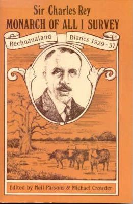
The extent to which the British subordinated Botswanan interests to those of South Africa during this period became clear in 1950. In a case that caused political controversy in Britain and across the Empire, the British government banned Seretse Khama from the chieftainship of the Ngwato and exiled him for six years. This was done in favour of South Africa, who objected to Khama’s marriage to a British woman at a time when racial segregation was enforced in South Africa.

Independence

A2042406-1557-49B3-8898-3569BB7C75FDIn the 1950’s, the idea of an independent Botswana germinated.  In 1962, the moderate Bechuanaland Democratic Party formed and set a timetable for independence and a new nonracial constitution, drawing on support of the local chiefs.  The British gratefully accepted the BDP’s peaceful plan for a transfer of power, and Khama was elected president when general elections were held in 1965. On 30 September 1966, the country – now called the Republic of Botswana – was granted full independence.  The BDP has been in power ever since, winning 38 of 57 seats in last month’s election.  On November 26, 2019, joint opposition parties challenged the results of voting in 19 constituencies, a move that could result in the country’s electoral commission calling fresh elections in those districts, so the long hold of the BDC may be starting to fracture.

Sundowner Cruise on the Chobe River

B3133423-7427-4AC8-A4D8-2054103748C0

After checking into the lovely Chobe Safari Lodge, we took a late afternoon boat ride.  The Chobe River runs through the park, and there are islands and tributaries making an excellent home for many creatures, including the incredible hippopotamus.

The River Horse
Status:  Vulnerable

F67A0AB8-1345-4018-B7D1-F37C1837FD32

The hippopotamus must be one of the most unusual animals on the planet.   Despite their physical resemblance to pigs and other terrestrial even-toed ungulates, the closest living relatives of the Hippopotamidae are cetaceans (like whales, dolphins, porpoises) from which they diverged about 55 million years ago.

Hippopotamuses love water, which is why the Greeks named them the “river horse.” Hippos spend up to 16 hours a day submerged in rivers and lakes to keep their massive bodies cool under the hot African sun. Graceful in water and good swimmers, they can hold their breath underwater for up to five minutes. However, they are often large enough to simply walk or stand on the lake floor, or lie in the shallows. Their eyes and nostrils are located high on their heads, which allows them to see and breathe while mostly submerged.   Both reproduction and childbirth occur in water.

925EB28B-F926-4338-906F-9D8CC8ABC198Although hippos lie close to each other in the water, they are actually solitary and do not seem to form social bonds except between mothers and daughters. Occasionally, they will bask alone on the shore, and if their skin cracks, they secrete an oily red moisturizer which gave rise to the myth that they sweat blood.  They rise gracefully from the banks of the water at night to graze alone on about 40 kilo of grasses.  After a night of feeding, they return to the water in the exact same place, so you do not want to get between her and the water.

Their powerful jaws are capable of opening up to 150 degrees revealing their enormous incisors.  Male hippos appear to continue growing throughout their lives as do their ivory canine teeth which can reach 50 cms long.  On land, they are capable of running 30 km/h over short distances.  The hippo is highly aggressive and unpredictable and all these factors make the hippo one of the most dangerous animals in the world.

Hippos have long been popular zoo animals. The first zoo hippo in modern history was Obaysch, who arrived at the London Zoo on 25 May 1850, where he attracted up to 10,000 visitors a day and inspired a popular song, the “Hippopotamus Polka.”

https://youtu.be/qW0EdkFtfBM

We saw loads of these unique creatures today.

We also saw the Waterbuck, whose unusual backside markings are explained by the joke that the waterbuck was the first antelope to use the freshly painted toilets on Noah’s Ark.

Some of the critters we have seen before were here, too.

Chobe being what it is, we didn’t have to leave our hotel before we saw wildlife.
E5EA676A-4953-4503-B20F-322B7C4C753A
We got up at the break of dawn for a game drive in the park.  No sooner had we registered with the park ranger and pulled into the park, than we saw these beauties:

We saw some more beautiful animals I have already described, as well as the hideous monitor lizard and a pair of alligators fighting, but the fellow in behind gave up quickly.

Spring is an absolutely lovely season to visit, we saw so many adorable babies!

75B8B782-4FF1-42ED-AE1E-C48B84B6E5D3

The warthog mama and her babies were an adventure, because they were living under the porch of my cabin and I had to be escorted to my room by security.  You don’t want to come between this mama and her little ones, she has nasty, razor-sharp  tusks and is perfectly willing to use them in their defence.   I felt quite sorry for her – how hard it must be to raise little ones when you can’t talk, have no thumbs, are surrounded by predators and find yourself trying to raise them among the bedlam of a sprawling hotel.  All three of them had to back into the hole she made one at a time to access the safe space under my porch.

Tis group of elephants strolled past us so closely that we held our breath when these two turned toward us and shot us a meaningful glance – but one look at us oldsters and they shrugged, turned and carried on.

DB6CD290-5C30-490E-B985-BA334DEB17AA

Best,

Jan

The Caprivi Strip

C926BF1D-E812-41B4-99EA-22BC6704CDFD


As we learned in Gibralter earlier this year, sometimes a weird bit of geography – the long, thin extension of Namibia that stretches out between Angola and Botswana through to Zambia and Zimbabwe – is formed when competing governments are horse-trading land.  This happened here in Namibia, too – over what became known as the “Caprivi Strip” (recently renamed the Zambezi region).  However, history makes some sense of it.


Leo von Caprivi (pictured right) was the German politician who succeeded Bismarck as chancellor in 1890.   He struck a deal with Britain, trading the islands of Zanzibar for Heligoland, a group of islands just northwest of Hamburg.  The Germans stipulated that they wanted this little strip of land all the way down in southern Africa because it leads to the Zambezi River which they thought would give them access to the Indian Ocean.  Were they fooled!  Either they didn’t look at a map or visit the area or even consult with anyone local, because a little thing now called Victoria Falls make the Zambezi River completely unnavigable.   Bismarck huffed that the Heligoland trade had been a bust, and that Germany had traded away its entire “trousers for a button.”

Whether a strip, or a button, the Caprizi strip makes a nice path for tourists to the Falls.

Chobe River landscape, view from Caprivi Strip on Namibia Botswana border, Africa. Chobe National Park, famous wildlilfe reserve and upscale travel destination.

Looking at this pastoral, lovely countryside, it is hard to imagine that civil war raged here in the 1990’s as a local rebel group, the Caprivi Liberation Army, tried to secede from Namibia.  Life in Africa is complicated, and it is unclear whether this war was the result of side-taking during the war in nearby Congo or a carryover from the Angolan war and the seeds of socialism left by the likes of Che Guevera.

Brendan van Son is a travel blogger more intrepid than I.  Riding his motorbike across Africa, he describes his afternoon on the Caprivi Strip this way:

While driving through Bwabwata National Park, I see a herd
of elephants browsing through the shrubs in the distance.  I
stop, pull out my camera gear and photograph the scene in
awe.  As I pack up my equipment, I hear shuffling behind me.
I twist my head to see a large male elephant walking briskly
towards me.  I race to my scooter and jump on. I’ve left her
running just in case something were to come up; elephants,
zebra, antelope and even lions that can be found along the
strip.  I twist the throttle and toss my head over my shoulder
to see the big elephant is now chasing me down the highway
at full speed.  I’ve learned a couple things today.  My scooter
can outrun a male elephant – though just barely.  I drive off
again laughing hysterically.  Oh, the adventures I have!

I’d say he was lucky that elephant wasn’t an ostrich or a leopard, or he might have been in real trouble!

 The abundant rivers and water make this a green, lovely and productive agricultural area and we we saw small, traditional villages.

Mahango

We drove here on paved Hwy B8 then turned south on asphalt.  Eventually we  veered east again and drove along a sand path.  Every lodge we have come to has involved a road so rough you were sure you were going to sketchy accommdoations, and then you marvel at the beautiful lodge and wonder how it can possibly be provisioned.  This time,  we arrived at a beautiful jungly lodge on the Okahongo River.  We sat on the deck over the River and almost immediately spotted the eyes of hippos in the river and the lodge posts this sign because sometimes the hippos come up at night and eat all of the vegetation on the property.

We went on a stunning game drive this afternoon in the beautiful riverside Mahango Park.  Skulls of the animals in the park were on display at the entrance and we were to see many of the living versions.

65E1EE54-E9BC-48F1-A475-E6A41A80CABF

Puffs of clouds hung on the sky and there were beautiful vistas at every turn and we saw a magnificent Baobob tree (for context one of our group stood in front of it).

Mammals and a Reptile

We saw lots of animals, many of them new to us, some of them the most spectular in Africa:

97972E34-3784-4C22-BFE5-5E330954F987


– The Nam Buffalo (known as “Cape Buffalo” to South Africans).  


– Hippos, including a mother and child:

CB90185D-69B0-49FB-BD3B-48D15EDDBDD5


– the Crocodile


We saw many of the ugly cute Warthogs along the water.

We saw new ungulates, in order, the Common Antelope, Roan, Tsetseba and Sable:

We saw Baboons and the Mervet Monkey.  The baby had a little nursing then went into the shrubs to play.

Giraffes, Zebras and Elephants also appeared.  We are in Elephant territory now.

Birds

61AA5993-E96B-499A-813F-0186F7E93230


– Violet-Breasted Roller


EA3E92FB-2AD7-473B-B1B3-42993A0DD0F0


– Little Bee Eater


ED708F69-DA50-481C-9BD0-1A7A10061E16


– Swainson’s Spurfowl


D1C42387-C645-43A6-91C0-29ED0CBBA415


– The enormous Spare-winged Goose


7E568ED6-F5B2-41CD-AC3C-7F51D0EB64CB


– Goliath Heron (the largest heron in Africa (see how it dwarfs the ordinary heron next photo)


A6C3659A-1D5B-4E4A-88B2-6C739796EEE2


– Grey Heron


E9A101F2-E4DC-4A7F-B9F9-30B1C5F2DFE4


– Egret


A72F1E71-F9AA-4CB6-9305-B2A4D5F46C68


– Cape Vulture


This morning we had seen the Hammer Cock Bird, here we saw its enormous nest which is the nest for life of a pair of Hammer Cock Birds, and we saw the Jesus Bird.

African Sky

F6152C96-019B-448D-8EF8-9D45CA7F4C6B


A lightning storm hung over the sky – it was raining somewhere!


Our drive ended with a spectacular sunset.

Best,

Jan
PS. No hippos at the lodge overnight!

ǀUi-ǁAis to Twyfelfontein

Twyfelfontein Lodge

After driving half a day yesterday on unpaved roads with the final 40 or so  kilometres along the bumpiest road I have ever been on (my puffy-coat-in-a-bag made the perfect lumbar pillow), we were stunned to arrive at the gorgeous lodge.  After seeing almost no-one on the roads, here was a full parking lot.  The entrance was a beautiful winding walkway to the lodge in a gorgeous setting.

Today we had the full day to explore this area and we set out for the ancient San rock paintings.  The big sky has its own beauty and we passed this farmstead typical in the local countryside.

The San people inhabited this place because of the spring and the need for water, and named the place, “ǀUi-ǁAis,” meaning “waterhole.”

This place was uninhabited by Europeans until a severe drought after the end of WWII.  David Levin studied the feasibility of farming in 1947. He rediscovered the spring but struggled to extract enough water to sustain his family and his herd. Slowly becoming obsessed with doubts about the capacity of the spring an Afrikaans-speaking friend began calling him David Twyfelfontein (David Doubts-the-spring) in jest. When Levin bought the land and registered his farm in 1948 he gave it the name Twyfelfontein.  While commonly being translated as doubtful spring, a more accurate translation for the word twyfelis therefore “questionable” or “uncertain”.  History suggests that the San people knew very well the value of the spring and how to extract the water.

There are more than 2,000 rock engravings and paintings of animals and people here at this amazing UNESCO world heritage site.  The paintings are made with red ochre which has been used as a painting substance around the world and suggests the San bush people who created them were involved in trade with the outside world.

32A2069C-1B5D-4D79-B23F-DEEFB05B05AF

Genetic evidence suggests the San people are one of the oldest, if not the oldest, peoples in the world, going back perhaps 70,000 years. They have genetic traces that no one else in the world has, that put them at the root of the human tree – we are related to them, but they are not as closely related to us. They have unique markers that we don’t have.  The petroglyphs have been dated back to this age as well.

132393BC-5D77-4056-AEDD-4DACAB0B5C0A

As part of the UNESCO world heritage site designation, UNESCO has authenticated the engravings and paintings.  They state that:  “all the rock engravings and rock paintings within the core area are without doubt the authentic work of San hunter-gatherers who lived in the region long before the influx of Damara herders and European colonists. The setting of the Twyfelfontein rock art is also authentic and complete other than one small engraved panel which was removed to the National Museum in Windhoek in the early part of the 20th century, no panels have been moved or re-arranged.”

I’ve seen quite a few engravings in BC and I recently attended a seminar about ancient BC rock paintings by Canadian Indigenous people using red ochre.  My sister and I also got up before sunrise to see rock paintings at Zion Canyon in Utah.  But I’d never seen a site like this before.

We took a 45-minute guided clamber over the rocks to see some of the engravings.  They appear to have a range of purposes.  This one is thought to be a map of active water sources in the area.

Another was likely used to train young hunters of the various animal footprints, including those of humans.

Others depict animals not from this area at all, suggesting either very wide nomadic range or contact with other peoples, such as the image of a crocodile and one of a penguin.

And many clearly depicting the various animals in the region:

09248862-304E-4CF6-ABD9-A570BD9EF2B4


Possibly the most famous engraving is that of “White Lady,” which we did not see due to a lion roaming in that area.  Her lower half appears white with masculine features and clothing while her top half is black and is clearly a woman.  There are several interpretations of her, but I couldn’t help wondering if, like Pharaoh Hatshepsut of ancient Egypt, she was a tribe leader who had to disguise her female gender to gain respect.   She certainly looks like a powerful huntress.

Petrified Forest

The Petrified Forest is a group of at least 50 fossilized Cordaites trees between 240 and 300 million years old, making our ancient rainforest on the Canadian west coast of 1,500 year old trees, seem young.  Scientists have determined  these trunks haven’t grown in today’s Namibia but were washed down a river in ancient times when one of the many Ice Ages ended on the Gondwana continent.  Due to enormous pressure and over a period of millions of years, even the finest structures of the wood have been dissolved by silicic acid and replaced by quartz, resulting in perfectly conserved and completely petrified trunks.

These were pine trees – and you can clearly see the knots.  The petrified wood looks just like a normal tree but feels, weighs and sounds like rock.

Twee-blaar-kanniedood – “two-leave-can’t-die”

We finally saw the Welwitschia mirabilis, the plant unbelievably comprised of just two leaves, arranged so they can store water.  Like many of the desert plants of this arid region, the Welwitschia is thought to obtain most of its moisture from very fine mist blowing off the cold Atlantic Ocean. This allows the plants to survive but they grow very slowly.   Considered a living fossil, the plant is actually a tree that has been dwarfed and lives up to 1,500 years.  We saw some considerably younger, but older plants do exist.  Like the holly tree, the Welwitschia requires the cross-pollination of a female plant with a male.

This was not where our day ended, oh, no.  It was only warming up!

Desert Elephant Safari

Status:  Protected

We had the rest of the afternoon free and some of us took advantage of the time to take one of the tours offered by the Lodge.  We mounted our 12-seater 4×4 and headed off into the sand in the hopes of seeing some of the uniquely adapted elephants.  They are rare – there are only two groups of elephants, here and in Mali, North Africa.  They can survive several days without water and are capable of walking up to 70 km per day for water.  I’ve always associated elephants with water so I was curious to see these amazing animals that can live in a desert.

DDBFA240-5223-4CE8-A3C6-A059EFB3C8D1We would not have another chance to see them, so we climbed aboard our vehicle with our guide and drove for about an hour and a half crossing dry river beds and passing from the red desert we’ve become used to seeing, into the almost black, surreal landscape of Damalaland.

This is the land where the Damala speak the most beautiful language I had ever heard, with clicks and three other sounds depending upon where the tongue clicks in the mouth.  The sounds represent our x, q, etc.  We heard a number of the staff speaking to each other in the musical language.

33FF9969-E222-48EF-A929-F2BD29467687


We arrived at a small village with a water hole where we hoped to see the elephants.There was no sign of an animal but there were tracks and some fresh-looking scat. 

We carried on through a Baobob grove with their roots poking out haphazardly.

It wasn’t long before we saw in the distance a large grey shadow.  Success!  We found 3 elephants and were given lots of time to take photos and observe their behaviour.   

The desert elephant has longer legs than other elephants and a broader foot.

They feed off off of the fruits of the acacia tree, stretching their trunks up to smell for fresh fruit before violently shaking the fruit loose from the tree.   It was an awesome sight.

3FCE3CB7-8E19-41BB-8C19-5C5B5583A25C


We drove on parallel to a dry river bed.  Suddenly, a head popped up in the bushes and I was instantly swept back to my favourite childhood program, The Friendliest Giant.  A giraffe, not a puppet!  Here!


Our driver left his tracks and we moved into the trees to get a better look.  As we watched, more and more of these striking creatures appeared.  These would have been passing through – they are nomadic.  We watched them for awhile before they moved on.     

It was time to head back to the Lodge for dinner, but on our way back we spotted a large herd of ostriches and some baboons.

We stopped for refreshments watching the sun go down behind the hills and the incredible African light seemed to follow us home.

Best,

Jan


Swako and the Skeleton Coast

Swakopmund

Reminiscent of a charming German town in the 1800s, Swakomund hasn’t changed much from its former German settlement self and the architecture reflects this in the form of domes, towers, turrets, oriel windows, embellished gables and ornate bay windows.

We took a short ride around town to get us oriented, ending at the museum entrance.  The museum had something for everyone, a lot of information about the local geology with fabulous specimens of various semi-precious stones, petrified wood, archeological finds, and a very interesting room dedicated mainly to the indigenous peoples of Swakopmund.  It’s worth bearing in mind, though, that it also has a lot of taxidermy and a German perspective on the history of the German people who invaded this land.

The museum is on the water, with a scenic shoreline, a boardwalk out over the rocks and a few shops and cafes.  We wandered through the colourful craft market with lots of beautiful wares and fairly aggressive salesfolk who were not unwilling to barter.  Just beyond the market were some feathery Swakopians, guinea fowl and a spotted pigeon:

A9B19844-EA6B-4900-BDF6-D65839F0F9D7

There’s also a waterfront aquarium, the Krystall Gallery of local crystals and gemstones a couple of seafood restaurants on a pier over the Atlantic, The Jetty and The Tug, and other restaurants and craft shops.  It was a relaxing day and a nice break from being on the road before we headed up the coast.

The Skeleton Coast

26BA1CC1-63CE-4647-86B6-3B283A721E73

Leaving Swakopmund,we head north on C34 along the Skeleton Coast with civilization fading away over our shoulders.  The sea takes on a grey appearance and the sand dunes now seem to threaten.  We are halfway between the forbidden diamond territory to the south and the vacant coastline until Angola to the north.

Under the sea lies half a thousand shipwrecks beneath dangerous currents and a hostile shore.  Some of the ships’ skeletons were found far inland over the dunes.   Says a local ranger, “even if you survived the wreck you were probably doomed. You struggle ashore, overjoyed that you’ve been saved, and then realize that you landed in a desert and probably should have gone down with the ship.”

We stopped at a recent shipwreck – when the Namibians won independence, the South Africans literally abandoned ship and this one broke free in a high wind and drifted to this spot along the coast.  The cormorants now call it home.

4857558C-38BB-4AB2-8A9B-21C6D5BCEC44

Our destination is Cape Cross, where in the 15th century the Portuguese explorer Diogo Cao landed and, as was his practice, planted a cross at this site for navigational purposes.  The cross that remains is a replica – the original stone cross was taken by the Germans and is housed today in the German Historical Museum in Berlin.   However, Germany has agreed to repatriate the monument to Namibia in n effort to make amends for its colonial past.  The plan was for the German museum’s curator to personally escort the cross in August 2019, but so far it appears that has yet to take place.

Suddenly, after all the desolation, life!

Fur Seal
Status:  Least Concern (but trade in pelts and oil)

CE206D90-4AC6-4923-8DD4-576FC9213659

There are 24 fur seal breeding colonies along this coast and we stopped at Cape Cross where there are 80,000 to 100,000 seals.  The fur seal,  actually a species of sea lion, is not named “fur” for nothing.  The seal pups’ thick, soft, jet black fur are prized around the world, and the hunt is as contraversial here as the baby seal hunt in Labrador.  Adult pelts are too coarse but there is also a huge market for seal oil.

C78456A8-99E9-406E-A9A7-C66EF37C2C8F

The export of seal pelts dwarfs Namibia’s seal oil business—400,000 of them during the past decade—representing one of the largest trades of any mammal out of Africa. Most go to Turkey, where fashion mogul Hatem Yavuz has them made into “wild fur” coats. According to Seven Network, one of Australia’s main television networks, Yavuz controls 60 percent of the global market in seal products.

D650DD27-9A96-4F34-A1BE-096E23071BB5


We humans kill the seals for fashion, when their natural impulse is to save human life.  In September, 2011, a great white shark bit a man swimming nearby and his mates made a makeshift tourniquet using a wetsuit and two belts to stop him from bleeding to death.   The shark remained and patrolled dangerously close.  Eye-witnesses confirmed that a fur seal circled the men the whole time as they gradually waded ashore with the victim.  The seal kept the shark at bay and the man’s life was spared.

The fur seals in this colony are so populous –

– that the government culls the colony annually; this year’s cull was last week so the animals were more active and aggressive than usual.

Many had also just had their young so we were able to see the adorable babies.

They’re awfully cute, but they do not smell pretty.

They have many predators on land and in the ocean.  We saw a jackal roaming the outskirts of the colony, and saw lots of jackal tracks in the sand.

We stopped to look at the fields of lichen and watched the reaction when a small amount of water is poured on them.  Initially they looked completely brown and dead; add water, and they jumped to life.  I had read at the Swako museum that there are over 100 varieties of lichens in these fields.  The government has taken some steps to protect them, since most people don’t realize how delicate and alive these plants are.

We stopped to look at the fields of lichen and watched the reaction when a small amount of water is poured on them.  Initially they looked completely brown and dead; add water, and they jumped to life.  I had read at the Swako museum that there are over 100 varieties of lichens in these fields.  The government has taken some steps to protect them, since most people don’t realize how delicate and alive these plants are.

B517DDDC-7FAE-44DD-A77E-314976ADFC08


Some industrious locals were selling salt crystals they had harvested on the beach.  One looked like a beautiful ballet-shoe- pink rose.


We had to backtrack a bit along C34 to reach C35, the road that will take us inland to the northeast toward the Twyfelfontein area, where we are staying tonite.  The sun came out and the temperature is heating up again.  The pavement also ran out and we are back to the bumpy, noisy, dusty ride we had in the south.  Tomorrow, though, we will journey back 70,000 years.

Best,

Jan


The Scramble for Africa

B99B0215-363B-40A6-8604-69A715AD4FC2

The “Scramble for Africa” was the colonization of African territory by European powers during the “New Imperialism” period from 1881 to 1914. In 1870, only 10 percent of Africa was under formal European control; by 1914 it had increased to almost 90 percent of the continent.   There were different motivations for European colonizers, including desire for valuable resources, the quest for national prestige, tensions between pairs of European powers and religious missionary zeal.

1576BD1D-423D-4013-A422-E1B6E89C7963

Bismarck had his sights on Namibia and his dream of establishing an empire to rival that of Britain and France led to German colonization of Namibia in 1884.   At the Berlin Conference in 1883, Africa had been divided between various European nations – largely to the surprise of Africans. As a result, Germany ended up with this arid desert land that most Europeans saw little use in claiming.

CAF5559E-0E8A-4093-827F-D203ACE9E3C9

In 1889, 25 German troops landed at Walvis Bay disguised, ironically, as ‘tourists’.   (I wish there was a picture.)  Walvis Bay at the time was under British control, and the German troops could not simply march onto British territory in full battle gear.   

The German Colonial Administration was never fully in control of Namibia because of rebellions by the pre-colonial Namibian population.   What resulted was a genocide by the Germans of the Herero, Damara and Nama.   About 60,000 Herero were killed out of a total population of about 80,000 and thousands more Damara and Nama people were killed.  Those that survived were moved to concentration camps.    There are many images online of Namibians in chains.  It is thought to be the first instance of cultural genocide by a European nation.

Germany lost all its colonial territories after WWI, but Namibia didn’t gain independence; the next to conquer Namibia were the Afrikaaners, and eventually Namibia’s Indigenous people were subjected to Apartheid.  In May 1967, because of Apartheid in the country, the UN took over with the goal of independence.  In May 1968, the country was given the name Namibia.  It would take more than 20 years for free elections to take place.

16A25091-7C9B-4265-8122-B324ED194E35In 1990, having been instructed by the UN Security Council to end its long-standing involvement in Namibia and in the face of military stalemate in Southern Angola, South Africa negotiated a change of control and Namibia finally became independent on 21 March 1990.

Independence Day on 21 March 1990 was celebrated in Windhoek’s sports stadium which was attended by numerous international representatives, including the main players, the UN Secretary-General Javier Pérez de Cuéllar and President of South Africa F W de Klerk, who jointly conferred formal independence on Namibia. Sam Nujoma was sworn in as the first President of Namibia watched by Nelson Mandela (just released from prison) and representatives from 147 countries, including 20 heads of state.

It took until September 2019 for the German government to acknowledge there was a genocide:  “It is in the meantime clear that the crimes and abominations from 1904 to 1908 were what we today describe as genocide,” Development Minister Gerd Mueller said after meeting tribespeople on Friday, according to a ministry spokesman.


Today, the clothes that Herero women choose to wear is a permanent reminder of the tribe’s unsettling past and history.   The style of dress was introduced by the German wives of missionaries and colonialists who first came to the country in the early 1900s.  Their cultural dress, the “Ohorokova,” is a continued protest against the Germans who butchered them, making it a subversion of their former rulers’ fashion.    The attire is topped off by a cow horn-shaped hat, paying homage to their traditional identity as cattle breeders.  Before their arrival, most Herero were bare-breasted and wore front and back leather aprons, made from sheep, goat or game skins.

97874B93-DD50-40AA-B9DE-09C3A8EE0607

Negotiations with Germany are ongoing.  The tribes brought a lawsuit in the U.S. seeking compensation from plunder by Germany of human remains and other property of the tribes that ended up in New York institutions Like the American Museum of Natural History.  That suit was dismissed in early 2019 based on jurisdictional problems, but, with the over $70 billion in reparation to survivors of the Holocaust during WWII, the Herero are not giving up.

7EA1E205-5F35-408F-A379-1D904C186C24

And then, there is the matter of De Beers.  I’ll be looking at that soon.

Best,

Jan


Cape of Good Hope

Chappies


Chapman’s Peak Drive is considered one of the most spectacular coastal drives in the world, and you can see why in the gorgeous shots I downloaded from online above, and my shots below.  Above the road, vertical sandstone cliffs rise 700 metres to the summit of Chapman’s Peak while the cliff below drops away equally vertically. At the northern end of this 7 km series of twists and turns is the picturesque lobster fishing town of Hout Bay.


In 1607, the skipper of the ship, “The Consent,” found his vessel becalmed in Hout Bay and sent his pilot, John Chapman, to row ashore in the hope of finding provisions. The pilot later recorded the bay as – guess what? – Chapman’s Chaunce (chance) and the name stuck, becoming official on all East India charts.

In 1914, preliminary surveys on the road got under way. Surveying the route was a scary business – at times the surveying party was on all fours as they investigated the perpendicular terrain. The project appeared to be a ‘mission impossible’ but the Governor would not take no for an answer and eventually he ordered the ‘go ahead’ for the highway along the cliffs.  The spectacular roadway took seven years to complete, at a cost of ₤20 000, hewn out of the stone face of Sheer Mountain.  It opened to traffic on Saturday 6 May 1922 by the Governor of the Union of South Africa, His Royal Highness Prince Arthur of Connaught.

A656E6C5-1F7B-4AB1-B6E9-FA04AA220593

The road seemed doomed again for reasons familiar to us in B.C. – there were many dangerous, some fatal, rockfall accidents and landslides and through several lawsuits, the law evolved and the government was forced to take responsibility for the safety of the travelling public.  As a result of these incidents and the resulting liability, Chapman’s Peak Drive was officially closed to traffic indefinitely in January 2000 and was open and closed for the next few years.  The problems continued until 2009 when it re-opened after a year of major upgrades and repairs.  Chappies has remained open since then and is beloved by locals and tourists like us.


Along the way to the Cape, we came across these guys – the males are black, the females buff, and it is spring, after all, there are some very fresh chicks if you can spot them:


The Cape

240FA9EE-0A57-47BD-858B-096502E4D036

The Cape of Good Hope has been engrained in my mind since public school.   Originally claimed in 1488 by Portugese navigator, Bartolomeu Dias, and declared by King John II as the southern tip of the African continent, the Cape was so-named because its discovery was a good omen that India could be reached by sea from Europe.  While that part was true, the southern tip of Africa where the Atlantic and Indian Oceans meet is about 150 km southeast of here. Nonetheless, the Dutch certainly prospered from the discovery of this trade route to Indonesia and India.

The Flying Dutchman

298324C0-42FD-4B80-A980-13DF5EBA54D1                                         The Flying Dutchman by Albert Pinkham Ryderc, 1887

Legend and many literary references have it that the ghosts of the crew of  the ship, “The Flying Dutchman,” haunt the headland and its waters. It is said that the ghost ship can never make port, doomed to sail the oceans forever and that the crew will try to send messages to land or to people long dead.  In ocean lore, the sight of this phantom ship is a portent of doom.

F2CDDA63-F5B5-4503-A398-B653EF789058

There have been many reported sightings of the ship, or of a ship glowing with ghostly light.   On a three year educational voyage with his tutor and older brother, the future King George V,  recorded this in his journal:

July 11th. At 4 a.m. the Flying Dutchmancrossed our bows.
A strange red light as of a phantom ship all aglow, in the
midst of which light the masts, spars and sails of a brig
200 yards distant stood out in strong relief as she came up
on the port bow, where also the officer of the watch from
the bridge clearly saw her, as did the quarterdeck midshipman, who was sent forward at once to the forecastle; but on arriving there was no vestige nor any sign whatever of any material ship was to be seen either near or right away to the horizon, the night being clear and the sea calm. Thirteen persons altogether saw her… At 10.45 a.m. the ordinary seaman who had this morning reported the
Flying Dutchman fell from the foretopmast crosstrees on to the topgallant forecastle and was smashed to atoms.”

Whether good hope or bad omen, we were visiting the beautiful peninsula today.   It was atmospherically grab-onto-something-or-be-knocked-over windy.  The Cape Peninsula is a 100 km (60 mile) long spit of land at whose tip stands the most powerful lighthouse in the world.   


Look who dropped by while we were there [baboons]:


Yesterday we saw some beautiful scenery and some wildlife on Robbens Island, too – a tortoise, some oyster catchers and some Steenbok, a small species of antelope:


CE2555A0-4DF1-4722-9A3A-8B8550A78D1E

We have been hearing lots of African music at the V & A, and today being Saturday, we heard and watched some enthusiastic school-aged kids at Boulders Beach.


Penguins
Status:  Endangered (but recovering)

Two feet tall, brimming with head-cocking curiosity and hair-trigger irritability, the Jackass Penguins are among the most endearing sights on the Cape, and being thoroughly socialized, they grudgingly tolerate human presence.  Boulders Beach, with its gigantic beachball-round boulders, has one of only two land-based African penguin colonies.

Maybe you’ll fall in love with them as I did, watching this lovely video, and you’ll hear how they got their name, too:


Sure enough, we heard them heehawing when saw them today.


Living proof as to just how windy it was along the coast today:

B356BF72-1B0F-47B1-B15E-01758DE3B8A7

724D1EFA-2B7D-4019-81BF-03E383CF24B5


Home to about 2,600 species of flowering plants, the Cape Peninsula Nature Reserve is part of one of the six floral kingdoms in the world, the Cape Floral Kingdom.

The Boomslang

Beautifully situated on the eastern slopes of Table Mountain, our last stop today was at the breathtaking Kirstenbosch National Botanical Gardens dedicated to the preservation of plants indigenous to southern Africa.  Kirstenbosch includes a fragrance garden, a medicinal garden, 2,500 species of plants found on the Cape Peninsula, a Protea garden (the beautiful National flower), a braille trail, a cycad amphitheatre and a conservatory.  The indigenous fynbos, of which the protea is a type, are said to be at their best this time of year.


A special feature is the Centenary Tree Canopy Walkway – affectionately known as the Boomslang (a highly venomous bright green snake), and you can see why. This 130-metre steel-and-timber bridge snakes its way through and over the trees of the Arboretum, providing stunning views of the Garden and the Cape Flats.


Of course, where there are flowers, there are birds, and the Garden’s home to some beauties:


91747611-1005-47B7-8858-41FE01446CA9

All the senses were treated today!

Best,

Jan


Rolihlahla ✊🏼

B81A142F-13AE-4C23-980F-BDBFEE0C2A63


We visited Robben Island today, whose prison was once home to former South African president Nelson Mandela and many other members of the African National Congress (ANC.) The island is now a United Nations World Heritage Site. Our trip to the island offered a glimpse into the apartheid era as we toured the prison with a former political prisoner as our guide.


We saw the cell where Mandela lived for 18 years, with nothing but a mat on the floor to sleep on.  We saw the small yard where he could exercise and later he was permitted to plant the small garden at the back of the yard, which he used to hide pages of his manuscript that would become Long Walk to Freedom.


Many have compared South African Apartheid to southern American segregation, but South Africans argue that Apartheid was worse.  In South Africa, the 18% white race minority population was dictating to the 82% majority of black African population while the divide in the U.S. was roughly the opposite.  Apartheid was enshrined into the South African constitution, and Apartheid was advancing while the rest of the world was moving away from racial segregation.

Not to say that being black in America was or is easy, and Canadians have nothing to feel righteous about, considering the atrocities and the ongoing struggles of our Indigenous peoples.

1700-1800’s – Roots

In South Africa, informal segregation and slavery began almost as soon as the Dutch and British colonized the region.  In 1833, when Britain passed the Slavery Abolution Act, South Africa took a different path.   

====================

The Canadian Indian Act, first passed in 1876, is a Canadian act of Parliament that concerns registered Indians, their bands, and the system of Indian reserves. Indians needed permission to leave reserves and the government had to approve it like a passport.

====================

With industrialization in the 1800’s, racial policies and laws in South Africa became increasingly rigid. Cape legislation that discriminated specifically against black South Africans began appearing shortly before 1900.

Early 1900’s – Foundations

0D841B4F-A76A-4982-A492-FDF83221501C

Into this setting, on July 18, 1918, Rolihlahla Mandela was born into the Madiba clan in the village of Mvezo, in the Eastern Cape. His chosen name, Rolihlahla, given him by his father is an isiXhosa name that means “pulling the branch of a tree”, but colloquially it means “troublemaker.”   His father was Nkosi Mphakanyiswa Gadla Mandela, Chief and principal counsellor to the Monarch of the Thembu people, Jongintaba Dalindyebo.  He was appointed to the position in 1915, after his predecessor was accused of corruption by a governing white magistrate.

A71E0175-E6AE-4327-B283-A27F479B39FFIn 1930, Mandela’s father died from tuberculosis when Mandela was just 9 years old.  King Jongintaba Dalindyebo became Manela’s guardian.   Mandela lived at the Jongintaba homestead from age 9 to 16 and was raised with Jongintaba’s children. It was his first school teacher who gave him the Christian name, Nelson.  Hearing the elders’ stories of his ancestors’ valour during wars of resistance, he dreamed also of making his own contribution to the freedom struggle of his people.


====================

By 1930, there were 80 residential schools in Canada.  Indigenous  children were torn from their parents and placed in Residential Schools where they were “assimilated” – stripped of their culture and language.

====================

Mid-1900’s – Apartheid

Education is the most powerful weapon
which you can use to change the world.
– Nelson Mandela

56FEC61E-7551-4C4C-8148-BE8EAA191BBF

Mandela studied for a B.A. at the University College of Fort Hare but did not complete the degree as he was expelled for joining in a student protest.   On his return to the Great Place at Mqhekezweni, the King was furious.  In 1941, Mandela and his cousin ran away to Johannesburg.  Through acquaintances there,  he did his articles through a firm of attorneys – Witkin, Eidelman and Sidelsky.  He completed his B.A. through the University of South Africa and went back to Fort Hare for his graduation in 1943.

By this time, all of Africa, except Ethiopia, was colonized in a series of feudalized states in which white colonists controlled or owned most of the land and held all the power.

9F81657E-5668-416D-9A12-E7FA66AA186A


Mandela, increasingly politically involved from 1942, joined the African National Congress in 1944 when he helped to form the ANC Youth League (ANCYL).  He quickly rose up through the ranks of the ANC.

At the end of World War II, all of the African nations were given independence and most colonists were repatriated to their home countries.  It must have been a time of great optimism and hope for Africans.


But not so for South Africa.  In 1948, just three years after the war ended, the (former Afrikaner) National Party was elected, and Apartheid was enshrined in federal legislation and the country’s constitution.

4B806D96-4B24-4C39-BB49-0E5D174A9741

In 1950, the Population Registration Acclassified all South Africans into one of four racial groups:  “White,” “Black,” “Coloured” and “Indian.”  Places of residence were determined by racial classification.  From 1960–1983, 3.5 million Non-White South Africans were removed from their homes and forced into segregated neighbourhoods, in one of the largest mass evictions in modern history.

Most of these targeted removals were intended to restrict the black population to ten designated “tribal homelands”, also known as bantustans.  The government announced that relocated persons would lose their South African citizenship as they were absorbed into the bantustans.

Mandela continued to work his way up in the ANC through activism.  In 1952, he was chosen as the National Volunteer-in-Chief of the Defiance Campaign. He and 19 others were charged under the Suppression of Communism Act for their part in the campaign and sentenced to nine months of hard labour, suspended for two years.   He used this time to complete a 2-year law diploma which allowed him to practice law.

In 1955, the Strijdom government stacked the courts and the Senate, adding new positions and appointing pro-Nationalists.  In 1956, a joint sitting passed legislation that paved the way for what would ultimately leave whites as the sole group enfranchised with the right to vote.

On December 5, 1956, Mandela was arrested in a countrywide police swoop, which led to the 1956 “Treason Trial.” Men and women of all races found themselves in the dock in the marathon trial that only ended when the last 28 accused, including Mandela, were acquitted on 29 March 1961.

To be free is not merely
to cast off one’s chains,
but to live in a way that
respects and enhances
the freedom of others
.

– Nelson Mandela

1960’s  and 1970’s – Fighting Back, and Detention

Sharpeville

831E17F2-1FC1-4891-8457-11F45444D9CE

Sharpeville was the first major event to attract international attention.  On March 21, 1960, police killed 69 unarmed people in a protest in Sharpeville against the pass laws. This led to the country’s first state of emergency and the banning of the ANC. Mandela and his colleagues in the Treason Trial were among thousands detained during the state of emergency.  After a day of demonstrations against pass laws, a crowd of about 5,000 to 7,000 protesters went to the police station.

The South African Police opened fire on the crowd, killing 69 people and injuring 180 others.  There were 249 casualties in total, including 29 children. Many were shot in the back as they fled.  Photographer Ian Berry, who made this photo, initially thought the police were firing blanks.

In April 1960, the UN’s conservative stance on apartheid changed following the Sharpeville massacre, and the Security Council for the first time agreed on concerted action against the apartheid regime, demanding an end to racial separation and discrimination. On August 7, 1963, the United Nations Security Council passed Resolution 181, calling for a voluntary arms embargo against South Africa. From 1964 onwards, the US and the UK discontinued their arms trade with South Africa.

Apartheid policy was championed by the country’s prime minister, Hendrik Verwoerd, who was born and raised in Amsterdam.  He was responsible for the tightening of the laws and enforcement.  On April 9, 1960, a deranged white farmer shot Verwoerd in an assassination attempt that failed.  Six years later Verwoerd was stabbed to death in the parliamentary chamber by Demetrio Tsafendas, a Mozambique immigrant of mixed descent who said that the assassination was motivated by the great resentment he felt toward apartheid.

In May 1961, before the declaration of South Africa as a republic, an assembly representing the banned ANC called for negotiations between the members of the different ethnic groupings, threatening demonstrations and strikes during the inauguration of the republic if their calls were ignored.  When the government overlooked them, the strikers (among the main organisers was a 42-year-old, Nelson Mandela) carried out their threats.

The government countered swiftly by giving police the authority to arrest people for up to twelve days and detaining many strike leaders amid numerous cases of police brutality.  Defeated, the protesters called off their strike. The ANC then chose to launch an armed struggle through a newly formed military wing, Umkhonto we Sizwe (MK), which would perform acts of sabotage on tactical state structures. Its first sabotage plans were carried out on December 16, 1961, the anniversary of the Battle of Blood River.

In the face of massive mobilization of state security a massive national strike against Apartheid was called off early.

In June 1961, Mandela was asked to lead the armed struggle and helped to establish Umkhonto we Sizwe (Spear of the Nation), which launched on December 16, 1961 with a series of explosions.

Rivonia Trial

On January 11, 1962, using the adopted name David Motsamayi, Mandela secretly left South Africa. He travelled around Africa and visited England to gain support for the armed struggle. He received military training in Morocco and Ethiopia and returned to South Africa in July 1962.

On August 5, he was arrested in a police roadblock outside Howick while returning from KwaZulu-Natal, where he had briefed ANC President Chief Albert Luthuli about his trip.

Mandela was charged with leaving the country without a permit and inciting workers to strike. He was convicted and sentenced to five years’ imprisonment and, for the first time, spent time at Robben Island.

Within a month, police raided Liliesleaf, a secret hideout in Rivonia, Johannesburg, used by ANC and Communist Party activists, and several of his comrades were arrested.

On October 9, 1963, Mandela joined 10 others on trial for sabotage.

On April 20, 1964, while facing the death penalty, Mandela made a statement from the prisoner’s dock that inspired and motivated, and must have struck fear in some:

I have fought against white domination,
and I have fought against black domination.
I have cherished the ideal of a democratic and
free society in which all persons live together
in harmony and with equal opportunities.
It is an ideal which I hope to live for and to
achieve.  But if needs be, it is an ideal
for which I am prepared to die.

On June 11, 1964 Mandela and seven other accused, Walter Sisulu, Ahmed Kathrada, Govan Mbeki, Raymond Mhlaba, Denis Goldberg, Elias Motsoaledi and Andrew Mlangeni, were convicted and the next day were sentenced to life imprisonment. Goldberg was sent to Pretoria Prison because he was white, while the others went to Robben Island, where Mandela would spend the next 27 years of his life.

“A winner is a dreamer who never gives up.
– Nelson Mandela

I wondered what Mandela did in those 27 years and how it came to be that on his release he immediately became the key figure negotiating for an end to Apartheid with the South African government.  I think it is important to note that he was imprisoned with many of his ANC compatriots, and I imagine they found ways of meeting and continuing their work.   I found this article very illuminating about this difficult period:

https://www.npr.org/sections/parallels/2013/07/01/197674511/nelson-mandelas-prison-adventures

Soweto Uprising

In 1976, secondary students in Soweto took to the streets in the Soweto uprising to protest against the imposition of Afrikaans as the only language of instruction. On June 16, police opened fire on students protesting peacefully. According to official reports 23 people were killed, but the number of people who died is usually given as 176, with estimates of up to 700.  In the following years several student organizations were formed to protest against apartheid, and these organisations were central to urban school boycotts in 1980 and 1983 and rural boycotts in 1985 and 1986.

The UN Security Council also condemned the Soweto massacre in Resolution 392.   In 1977, the voluntary UN arms embargo became mandatory with the passing of Resolution 418.

1980’s – Progress

On March 31, 1982, Mandela was transferred to Pollsmoor Prison in Cape Town with Sisulu, Mhlaba and Mlangeni. Kathrada joined them in October. When he returned to the prison in November 1985 after prostate surgery, Mandela was held alone.  Justice Minister Kobie Coetsee visited him in hospital.  Later, Mandela initiated talks about an ultimate meeting between the apartheid government and the ANC.

In the early-1980s, Prime Minister Botha’s National Party government started to recognise the inevitability of the need to reform the apartheid system.  Early reforms were driven by a combination of internal violence, international condemnation, changes within the National Party’s constituency, and changing demographics – whites constituted only 16% of the total population, in comparison to 20% fifty years earlier.

The drive for change must have come out of a prevailing sense of dread in the white South African population.  Underlying Apartheid was always Africa’s geography itself, (so ironic considering the Dutch East Indies Company’s original success as mariner):  the white minority population living off the tip of Africa was terrified that the majority black population might rise up and run them all into the sea.

Concerned over the popularity of Mandela, Botha denounced him as an arch-Marxist committed to violent revolution, but to appease black opinion and nurture Mandela as a benevolent leader, the government transferred him from Robben Island to Pollsmoor Prison just outside Cape Town where prison life was more comfortable for him. The government allowed Mandela more visitors, including visits and interviews by foreigners, to let the world know that he was being treated well.

In January 1985, Botha stated that the government was willing to release Mandela on condition that Mandela pledge opposition to acts of violence to further political objectives. Mandela’s reply was read in public by his daughter Zinzi – his first words distributed publicly since his sentence to prison twenty-one years before. Mandela described violence as the responsibility of the apartheid regime and said that with democracy there would be no need for violence.

In 1986, the South African government began making its first serious overtures, and Mandela was secretly driven from the prison to the home of Kobie Coetsee, the justice minister, who would meet often with Mandela in the years that followed.

After much debate, by the late-1980s, the U.S., the U.K. and 23 other nations had passed laws placing trade sanctions on South Africa. A disinvestment from South Africa forbidding corporations from doing business with South African firms was also imposed.  The sports world also shunned South Africa and its athletes.

Between 1987 and 1993, the National Party entered into bilateral negotiations with the ANC for ending segregation and introducing majority rule.

On August 12, 1988, Nelson was taken to hospital where he was diagnosed with tuberculosis. After more than three months he was transferred to a house at Victor Verster Prison near Paarl where he spent his last 14 months of imprisonment. He was released from its gates nine days after the unbanning of the ANC. Throughout his imprisonment he had rejected at least three conditional offers of release.

1990’s – Freedom!

After 26 years in captivity, Nelson Mandela did not want to be set free straight away. Two days before his release, the world’s most famous political prisoner was taken to see President F.W. de Klerk in his Cape Town office. President de Klerk got a surprise.  “I told him he would be flown to Johannesburg and released there on February 11, 1990. Mr Mandela’s reaction was not at all as I had expected,” said De Klerk. “He said: ‘No, it is too soon, we need more time for preparation.’ That is when I realised that long hours of negotiation lay ahead with this man.”

FBAEB482-753C-4EB6-B4FA-41E9EBA00009

Just after 4pm, Mandela, then 71, walked free from Victor Verster prison, in Paarl, near Cape Town. Mandela held up his fist in an ANC salute. In an instant he switched from being a symbol of the oppressed to the global symbol of courage and freedom that he remains today.

“The cameras started clicking like a great herd of metallic beasts. I raised my right fist and there was a roar.  I had not been able to do that for 27 years and it gave me a surge of strength and joy.”

Four hours after leaving prison, Mandela arrived in Cape Town to address thousands of people gathered outside city hall. The impatient crowd had clashed with police and bullets had been fired. But Mandela did not bring a message of appeasement. “The factors which necessitated armed struggle still exist today,” he told the cheering onlookers.

Mandela immersed himself in official talks to end white minority rule and in 1991 was elected ANC President to replace his ailing friend, Oliver Tambo.

It always seems impossible until it’s done.
– Nelson Mandela

Apartheid was dismantled in a series of negotiations from 1990–91, culminating in a transitional period which resulted in the country’s 1994 general election, the first in South Africa held with universal suffrage.

In 1993 Mandela and President F.W. de Klerk jointly won the Nobel Peace Prize and on April 27, 1994, Mandela voted for the first time in his life.

866FD1E2-D7ED-448F-8E9B-B8668924F228

On May 10, 1994, Mandela was inaugurated as South Africa’s first democratically elected President.

Established in 1996, the Truth and Reconciliation Commission (TRC) was a court-like restorative justice body assembled in South Africa after the end of apartheid.  Witnesses who were identified as victims of gross human rights violations were invited to give statements about their experiences, and some were selected for public hearings. Perpetrators of violence could also give testimony and request amnesty from both civil and criminal prosecution.  The TRC, was seen by many as a crucial component of the transition to full and free democracy in South Africa.

====================

The Truth and Reconciliation Commission of Canada was active in Canada from 2008 to 2015, organized by the parties of the Indian Residential Schools Settlement Agreement. The purpose was documenting the history and lasting impacts of the Canadian Indian residential school system on Indigenous students and their families. The Commission concluded in December 2015 with the publication of a multi-volume report that concluded the school system amounted to cultural genocide.

========================

In 2005, Nelson Mandela spoke at the Live 8 concert in Johannesburg:

Sometimes it falls upon a generation to be great.
You be that great generation. Let your greatness
blossom. Of course the task will not be easy.
But not to do this would be a crime against
humanity, against which I ask all humanity
now to rise up.

In April 2007 his grandson, Mandla Mandela, was installed as head of the Mvezo Traditional Council at a ceremony at the Mvezo Great Place.

====================

On June 11, 2008 Prime Minister Stephen Harper stood in the House of Commons to offer, on behalf of the Government of Canada, an apology to Aboriginal peoples in Canada for the abuse, suffering, and generational and cultural dislocation that resulted from assimilative, government-sanctioned residential schools.

Conditions on most of the Canadian northern reserves remain poor, without access to clean drinking water and access to education mostly requiring children still to be separated from their parents to travel south.  The suicide rate is triple the rate of non-Indigenous.   The restorative justice work continues.

====================

Today in South Africa, problems remain, with a massive divide between wealthy whites and extreme poverty of most blacks.  At the end of Apartheid, land wasn’t transferred; blacks still don’t own land.  Some public housing projects have happened, but the homes were constructed within the Townships, those former bantustans and the land isn’t owned. Most still live in shacks.

The 2008 financial crisis led to massive job loss in the country’s biggest employment sector – mining.   Moody’s has South Africa’s credit rating at Baa3, the lowest investment-grade level, and has just slashed the country’s 2019 economic growth forecast for the second time.  If the agency downgrades South Africa again, it will kill foreign investment.  Tourism and other sectors are growing and there is a slowly growing black middle class, but there is still much economic work to do.


B78D196E-6DB8-4E5E-8BEE-D0BB4A14DE4B

On December 5, 2013, Rolihlahla “Nelson” Mandela, the first President of South Africa to be elected in a fully representative democratic election, as well as the country’s first black head of state, died at the age of 95 after a prolonged respiratory infection.  As he slipped off into sleep, I think he must have been satisfied that it was a life well-lived.  

Best,

Jan